Tuesday, 17 September 2013

Mile 2700ish- The Canadian Border!!!!

No, I haven't disappeared.  I finished my thru-hike on Monday, September 9th, 2013  along with E, Sycamore, Estero, and Malarky(a mere section hiker)  It has been a wonderous walk which I will talk about more in a later post.  Right now, I'll just talk about the section I've completed since the last post- From Lincoln to the border through The Bob Marshall Wilderness and Glacier National Park.

Technically, the section through 'The Bob' was on fire, so we were diverted around through another valley, which was still in Flathead National Forest but not in the Bob.  It was beautiful nonetheless, even with the smoke from the multiple fires around me being inhaled non-stop.  I was hiking mostly alone thru this stretch, and found it to be generally enjoyable and relaxing- no waiting, taking breaks when I wanted, getting turned around a few times in the 70+ mile reroute.  I ran into Malarky and Estero on my last day before East Glacier, so Estero got his ear talked off for about 1/2 a day as we were walking along 2 medicine creek.  Then into Glacier!  The trail actually goes through the park before you hit E. Glacier, but it's not a very exciting  part- quite overgrown and tree-y.

I had to get permits for camping inn the National Park, so I called the permit office from E Glacier and it worked better to wait another day before heading to Two Medicine, which meant another double zero!  I know, thru-hiking's tough sometimes....well anyway, the hospitality of that town is amazing.  Even at the end of their busy season, everyone was still nice and thankful towards us.

Then we went into Glacier NP, so amazing!  Even though it rained (read:dumped rain) on us at least once every day in the park, the views we did get a chance to see were just stunning.  I couldn't of asked for a better group of people to hike with either, with their dry wits and sarcasm, I felt right at home.  Here are some photos for your viewing pleasure:
Lewis and Clark did not pass through here, this is just named after them

A view from the divide- nearing sunset

Signage!


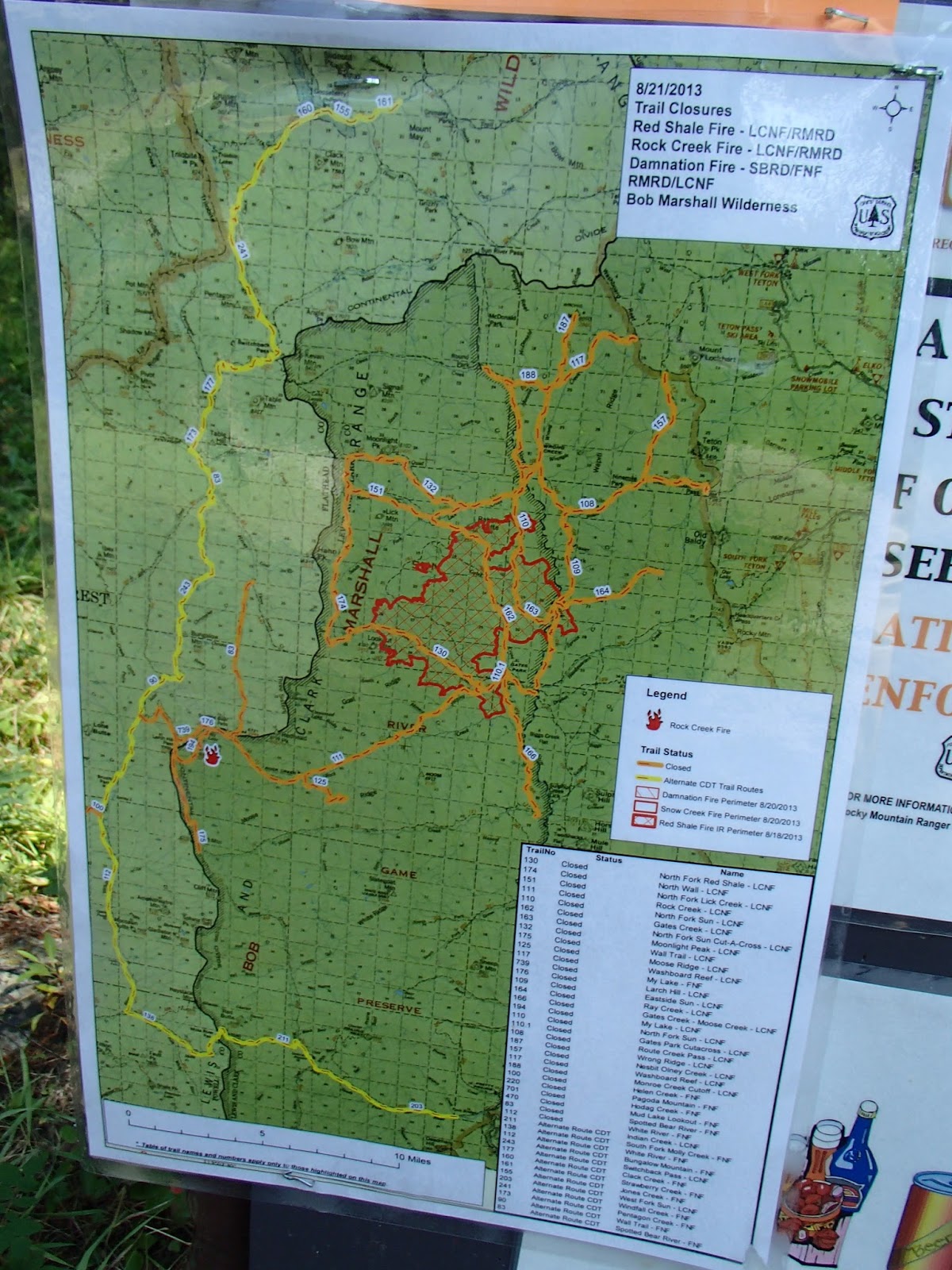
The map of the fire closure: red=on fire, orange=closed trails, yellow=the alternate route the CDT goes thru
In case you were confused by the map, there was a list of open and closed trails as well.
Benchmark wilderness Ranch- horses in the yard

Signage!

Sunset from my camp, first night in "The Bob"

That's smoke from the fires in the valley, not mist

Lake
Watching the storm roll over me from the front porch of a backcountry cabin

Thimble berries!

Ran into these guys in E. Glacier- hard to believe we started the CDT together almost 5 months ago!

The view from Two Medicine Store


Estero enjoying the view

Malarky on the edge of the mountain

Sycamore getting water before we got rained on.

Real friends share the dry tent pad.

The kitchen
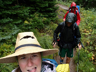
Hiking in the rain

Looking toward Many Glacier CG

I've officially walked in snow in all of the states on the CDT!(Minus Idaho)

Estero walking into the mist along the Ahern Drift

Grizzly prints on the last day

Welcome! But not really...

E, Neon, Estero, Malarky, and Sycamore are done!

Friday, 23 August 2013

Mile 2450ish- Lincoln, MT


I don't have much to say at the moment, just that my hike is still slowly making its way north.  I've been trying to slow down to make the timing work out, and it's been mostly impossible.  Once I'm used to hiking 25-30 miles a day, I apparently continue hiking at that pace.  I have to get a camping permit for Glacier NP, so that'll forcer me to slow down.  If anyone has any good book reccomendations, let me know.  I'll hopefully be able to pick one up in East Glacier- my last town stop before the border.  For now, here are some photos!
Storm Lake Pass.  Find the hiker on the trail!

Treat this wooden water pipe segment with respect!

This is a segment of the flume that carried water downhill until 2011...

Attempted boarding up of an old mine?

Another smoky day on trail- thanks for burning, Idaho/Montana.

Self portrait near the beginning of a 25 mile dry road walk.
Thank goodness for a breeze and some shade!

There's a mummified-looking squirrel at the bottom of this water source.
Dana Spring, near Mullen Pass, MT


Morning moonset.


How Hiker Trash gets around Lincoln, MT.
AKA- Dain giving Sweet As a lift.

Friday, 16 August 2013

Mile 2300ish- Anaconda, MT

I found the end of the Missourri River!  At Lemhi Pass
Hello from the 9th largest "city" in Montana!  Not much is going on here, as well as not much has been happening on trail these past few days.  I've been going into and out of different valleys about 4-8 times per day, as well as getting beautiful views from the passes.  As Balls put it the other day when he and Sunshine caught up to me coming out of Lost Trail Pass, "We're getting to the point in the hike where it's still enjoyable, but we want to be done"(or something to that effect)  I've definitely been feeling the same way- it doesn't help that the terrain has mostly looked the same for the past couple of weeks. 
It is definitely sad when you get to the point on a hike where you're viewed out, so I've been trying to notice the little things- the beauty in the sunrises/sets (because of the smoke from all the wildfires around here), the animals and how they respond to my presence, the wildflowers whose blooming has been following me since the Wyoming/Colorado Border.  It's become more and more apparent to me throughout this trip, as well as my life's journey, that I get to choose my mood.  I choose whether my day will be boring or that the intricacies of the moments can be woven together to create something more.  Try it sometime!

Baby Bear!  Mama ran away as soon as I made noise

Tuesday, 6 August 2013

Mile 2100ish- Leadore, ID

The bears are out- my size 10 and a Grizz print
The berries are out too!
Well, I've nearly made it to my final state!  We are currently, at times literally, straddling the Idaho/Montana border.  I've been fondly calling it 'Montaho'  and giggling a bit to myself, but that's my entertainment here on the trail.  
Music on Main in Victor, ID
After leaving Dubois, I hike for a few days into Yellowstone NP and then promptly hitched into Jackson to visit a PCT friend of mine- Emilee- and hang out with her for a few days.  After delicious fresh greens, a concert in Victor, ID, a couple naps, and sooo much good friend hang out time I was back in Yellowstone hiking in a generally northerly direction.  I've also ran into my first of many southbound CDT hikers in the park, and everyone's been quite friendly. 
Canoers offered to take me across the Lewis River. With Shoshone Lake.
Getting out of Yellowstone, I began hiking with E again, and we have run into TONS of southbounders, and have been trying to give them useful info- where the dry spots are, what the terrain's like, etc.  We've been following the border since we left the park, and it's been very up and down which is interesting, since Yellowstone was quite flat.  I'm working on getting my leg muscles used to climbing again.  On to actual Montana!  I should be in Anaconda in about 10 days or so, which is about 1/2 way through MT.


Old shoes/new shoes in Old Faithful Village.

Tourists on the boardwalk out of O.F. Village

Welcome to Idaho!

SoBo Smiles!(a PCT friend)

A storm rolling in over the mountain

Following the fenceline on the ID/MT border

Big sky Country, indeed.

E and our hitch into Leadore.