Friday, 23 August 2013

Mile 2450ish- Lincoln, MT


I don't have much to say at the moment, just that my hike is still slowly making its way north.  I've been trying to slow down to make the timing work out, and it's been mostly impossible.  Once I'm used to hiking 25-30 miles a day, I apparently continue hiking at that pace.  I have to get a camping permit for Glacier NP, so that'll forcer me to slow down.  If anyone has any good book reccomendations, let me know.  I'll hopefully be able to pick one up in East Glacier- my last town stop before the border.  For now, here are some photos!
Storm Lake Pass.  Find the hiker on the trail!

Treat this wooden water pipe segment with respect!

This is a segment of the flume that carried water downhill until 2011...

Attempted boarding up of an old mine?

Another smoky day on trail- thanks for burning, Idaho/Montana.

Self portrait near the beginning of a 25 mile dry road walk.
Thank goodness for a breeze and some shade!

There's a mummified-looking squirrel at the bottom of this water source.
Dana Spring, near Mullen Pass, MT


Morning moonset.


How Hiker Trash gets around Lincoln, MT.
AKA- Dain giving Sweet As a lift.

Friday, 16 August 2013

Mile 2300ish- Anaconda, MT

I found the end of the Missourri River!  At Lemhi Pass
Hello from the 9th largest "city" in Montana!  Not much is going on here, as well as not much has been happening on trail these past few days.  I've been going into and out of different valleys about 4-8 times per day, as well as getting beautiful views from the passes.  As Balls put it the other day when he and Sunshine caught up to me coming out of Lost Trail Pass, "We're getting to the point in the hike where it's still enjoyable, but we want to be done"(or something to that effect)  I've definitely been feeling the same way- it doesn't help that the terrain has mostly looked the same for the past couple of weeks. 
It is definitely sad when you get to the point on a hike where you're viewed out, so I've been trying to notice the little things- the beauty in the sunrises/sets (because of the smoke from all the wildfires around here), the animals and how they respond to my presence, the wildflowers whose blooming has been following me since the Wyoming/Colorado Border.  It's become more and more apparent to me throughout this trip, as well as my life's journey, that I get to choose my mood.  I choose whether my day will be boring or that the intricacies of the moments can be woven together to create something more.  Try it sometime!

Baby Bear!  Mama ran away as soon as I made noise

Tuesday, 6 August 2013

Mile 2100ish- Leadore, ID

The bears are out- my size 10 and a Grizz print
The berries are out too!
Well, I've nearly made it to my final state!  We are currently, at times literally, straddling the Idaho/Montana border.  I've been fondly calling it 'Montaho'  and giggling a bit to myself, but that's my entertainment here on the trail.  
Music on Main in Victor, ID
After leaving Dubois, I hike for a few days into Yellowstone NP and then promptly hitched into Jackson to visit a PCT friend of mine- Emilee- and hang out with her for a few days.  After delicious fresh greens, a concert in Victor, ID, a couple naps, and sooo much good friend hang out time I was back in Yellowstone hiking in a generally northerly direction.  I've also ran into my first of many southbound CDT hikers in the park, and everyone's been quite friendly. 
Canoers offered to take me across the Lewis River. With Shoshone Lake.
Getting out of Yellowstone, I began hiking with E again, and we have run into TONS of southbounders, and have been trying to give them useful info- where the dry spots are, what the terrain's like, etc.  We've been following the border since we left the park, and it's been very up and down which is interesting, since Yellowstone was quite flat.  I'm working on getting my leg muscles used to climbing again.  On to actual Montana!  I should be in Anaconda in about 10 days or so, which is about 1/2 way through MT.


Old shoes/new shoes in Old Faithful Village.

Tourists on the boardwalk out of O.F. Village

Welcome to Idaho!

SoBo Smiles!(a PCT friend)

A storm rolling in over the mountain

Following the fenceline on the ID/MT border

Big sky Country, indeed.

E and our hitch into Leadore.

Saturday, 20 July 2013

Mile 2100ish- Dubois, WY

"Be careful of bears around here. I'd hate to find your (looks me over) red bandana laying in the woods soaked in blood"
-Man on a 4-wheeler outside of Encampment with a pistol on his hip
 
Made it to Wyoming!
Call Don for info
Man, it seems as though these past few weeks have flown by now that they're over.  Though, as I was walking through the desert before Rawlins, wondering where the shade was or going up a steep pass for the third time in a day in the Winds; time seemed to go so slow.  It's amazing how relative a thing time becomes when you spend most of your waking hours hiking north with nothing to destract you from your wandering mind. 

No, I didn't use the zoom on this photo
From Steamboat, we went back up into the mountains of Colorado, only with heat and bugs being our adversaries instead of wind and snow- my how quickly the seasons change.  Entering into Wyoming a couple days later, Bob, Speedbump, and I got the wonderful opportunity to catch the fourth of July fireworks in Encampment, WY.  The firefighters of the town were setting them off in the baseball field- lighting them by hand with acetaline torches.  Ahhh, small town america. 
Then I was off to Rawlins, hiking alone for the first time on this trip, which I must say was very enjoyable even when I was getting lost on a daily basis.  It's nice to know I can be self-sufficient and find my way from one place to another eventually.

Double rainbow leaving Rawlins!
After Rawlins, I met up with Pod and Gnar again, and we began hiking into the Red desert- It was quite hot and inhospitable.  Luckily, we were hiking near Balls and Sunshine who were being car supported by Balls' wife and Sunshine's mom, Teresa.   Just when I didn't think I could get any hotter, they'd come driving by and offer me a cold soda or some water or watermelon!  It was a revitalizer for sure, I felt spoiled by them at times.

The Red Desert looked mostly like this, minus the clouds.
Then into Atlantic City, a wonderfully small respite on the edge of the desert.  I wasn't sure I had enough food to make it the entire 140-mile stretch that we were about to do through the Wind River Range, but thankfully Gnar and Pod had a few extras they threw my way and we trudged back into the mountains, picking up E in South Pass City- she had recently done a 40 mile day to celebrate her 40th birthday- another badass woman!
The Winds were gorgous- I'll definitely have to come back and hike through Knapsack Col and some of the other Alternates that J.Ley suggests.  Even thinking we had enough food, we almost ran out and were rationing the last couple of days. Also, we're officially in bear country with a few grizzley prints spotted in the northern section near Tohgatee Pass.  So we've been hanging our food and smellables, as well as cooking away from our tents and carrying bear spray- just in case.  In this next section, we'll be going through Yellowstone NP and up along the Idaho/Montana border- I can't wait!
The traveling Blueberry strikes again!
 
Leaving Atlantic City, WY


Thank you trail crew! Their horses were thirsty.


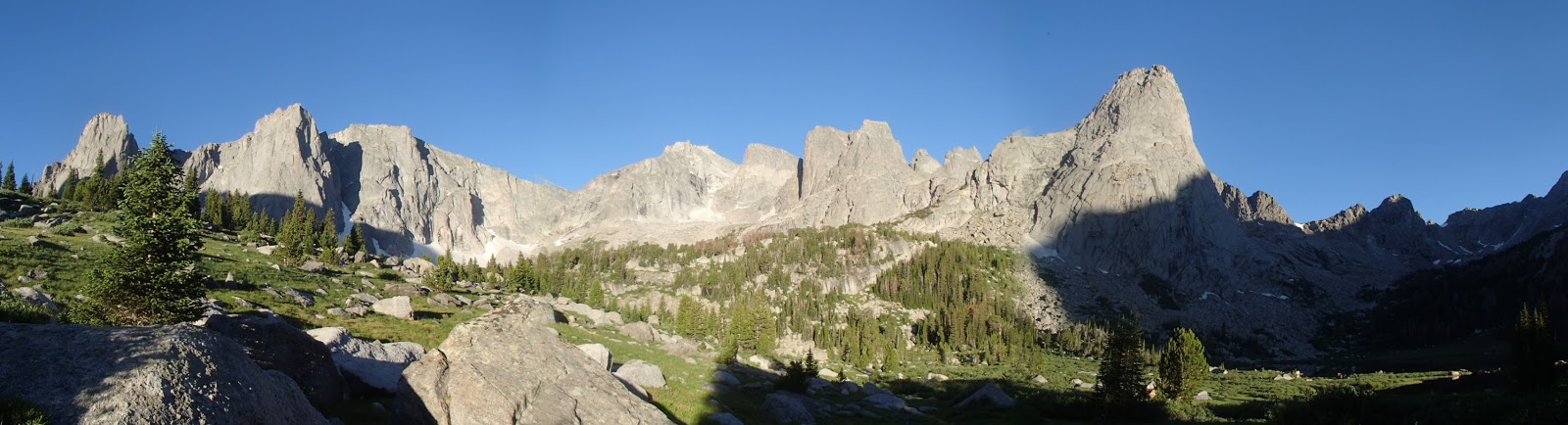
Cirque of the Towers from near Lonesome Lake


The Winds has signage


So excited, even after pass number 10 or so of the day.


The Green Lakes are really green from Glacial runoff


This aggressive grouse was following me and trying to peck me.

Sunday, 30 June 2013

Mile 1260ish- Rabbit Ears Pass/Steamboat Springs, CO

Old shoes with 600 miles on them vs. new shoes
Gray's Peak- highest point on the CDT!


Trail along the ridge
Well, it's been a lovely week in Colorado, now that there's less snow to plow/swim/slosh through.  Unfortunately, that window of time before the bugs come out began closing as we left Frisco- good thing I picked up my bug net and Deet!  Hiking along, we've been able to do larger mileage mostly, though the elevation has begun changing from going up and staying up to up and down and up again.  We hit our lowest elevation-wise points on the trail in Colorado going into Grand Lake.  At a measly 8,000 something feet in elevation, I felt like I was drinking the air it was so thick! 
Everyone making dinner on the fire
We will soon be moving onto a new state- Wyoming- and leaving the high elevation for a while as well, dropping down into the desert before heading back up into the Wind River Range.  My brain has begun to feel fried coming into towns sometimes, and that's how I know I've been in the woods for not long enough!
Goodbye CoolRadBro, Hello WingNoming!
Sometimes the trail looks like this...


Storm clouds rolling in at Devil's Thumb Pass

Pos, Gnar, and I before heading into Steamboat.

Bob, Speedbump, and Kim floating down the Yampa River in Steamboat

Monday, 17 June 2013

Mile 1,020ish- Frisco, CO

Gnar and Max Chill having a Meat Stick Joust
Signage!
Wow, it has been a whirlwind these past couple days!  I've been visiting with friends and family, as well as saying goodbye- some forever and some just for now.  It seems as though my thoughts are going at a mile a minute at the moment, so my apologies if this post gets a bit confusing.  I'll try to go in order.
Pod calls these "snow hurdles". They suck.
Max Chill out front walking the ridge into Monarch Pass.

So we left Lake City, and I was hiking with Gnar, Pod, and Max Chill.  The snow was beginning to melt faster, so as we were going through it, our feet were cold because of the post-holing/slushy snow and the rest of our exposed skin was getting sunburnt.  It was neat to have been through this area before, so I saw how different it looked with snow vs. with all the rain we got in the Colorado Trail last year.  So I haven't taken nearly as many photos, but it's been enjoyable nontheless.


We did have some scary moments, though not nearly as many as the last section.  Most of them involved being in a big field at 11,000ft when a thunder storm would decide to roll in- never fun.
We made it to Salida in time to have a night in the hostel right before a group of roller derby girls.  Thankfully, there is a trail angel there who hosts up to 3 hikers in her apartment.  AND she drove us back to the trail- Thanks Liv!

Don't go this way!  ...unless you're on the CDT...
Since Salida, we've been moving at quite a faster pace than before- instead of only covering 15 miles because of the snow, we're now up to 20-23 miles per day.  This has been tiring some days, going up and down and up passes.  It's also felt a bit more rewarding.  We're no longer not wanting to look at our maps to see how many miles we did, (because we'd be disappointed at so few) we're looking and being pleasantly surprised at the mileage.  I've got to honest though, I can't wait to get to Wyoming and burn up some big mile days in the desert! 

When we got to Frisco, Gnar, Pod and I found out our friend Max Chill was planning on getting off trail.  It was sad to see him go, and I also know he needs to do what's best for him.  We also found out via another hiker that the infamous gentleman who drove us to the Crazy Cooke Monument at the Mexico/United States border has passed away.  Sam Hughes- you were a lovely/humorous man and will be gratefully remembered by many.
Pod and Gnar break time!

Looking down toward Lake Ann from next to the cornice.
A Colorado storm rolling in.
Learning about the ghost town we're walking through.


Pod sneak-attacking a dog atop Mt. Elbert

This helicopter flew about 50 ft over us atop Mt. Elbert- they waved.

Watch out! Near Camp Hale- an old army barracks.

This is what happens to your shirt if you wear it for 1,000 miles

The last hurdle before Frisco

Frisco! And Friends!