No, I haven't disappeared. I finished my thru-hike on Monday, September 9th, 2013 along with E, Sycamore, Estero, and Malarky(a mere section hiker) It has been a wonderous walk which I will talk about more in a later post. Right now, I'll just talk about the section I've completed since the last post- From Lincoln to the border through The Bob Marshall Wilderness and Glacier National Park.
Technically, the section through 'The Bob' was on fire, so we were diverted around through another valley, which was still in Flathead National Forest but not in the Bob. It was beautiful nonetheless, even with the smoke from the multiple fires around me being inhaled non-stop. I was hiking mostly alone thru this stretch, and found it to be generally enjoyable and relaxing- no waiting, taking breaks when I wanted, getting turned around a few times in the 70+ mile reroute. I ran into Malarky and Estero on my last day before East Glacier, so Estero got his ear talked off for about 1/2 a day as we were walking along 2 medicine creek. Then into Glacier! The trail actually goes through the park before you hit E. Glacier, but it's not a very exciting part- quite overgrown and tree-y.
I had to get permits for camping inn the National Park, so I called the permit office from E Glacier and it worked better to wait another day before heading to Two Medicine, which meant another double zero! I know, thru-hiking's tough sometimes....well anyway, the hospitality of that town is amazing. Even at the end of their busy season, everyone was still nice and thankful towards us.
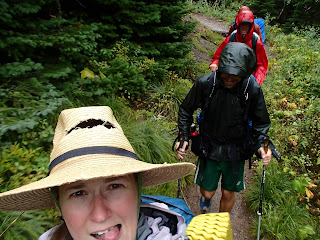
Then we went into Glacier NP, so amazing! Even though it rained (read:dumped rain) on us at least once every day in the park, the views we did get a chance to see were just stunning. I couldn't of asked for a better group of people to hike with either, with their dry wits and sarcasm, I felt right at home. Here are some photos for your viewing pleasure:
 |
| Lewis and Clark did not pass through here, this is just named after them |
 |
| A view from the divide- nearing sunset |
 |
| Signage! |
 |
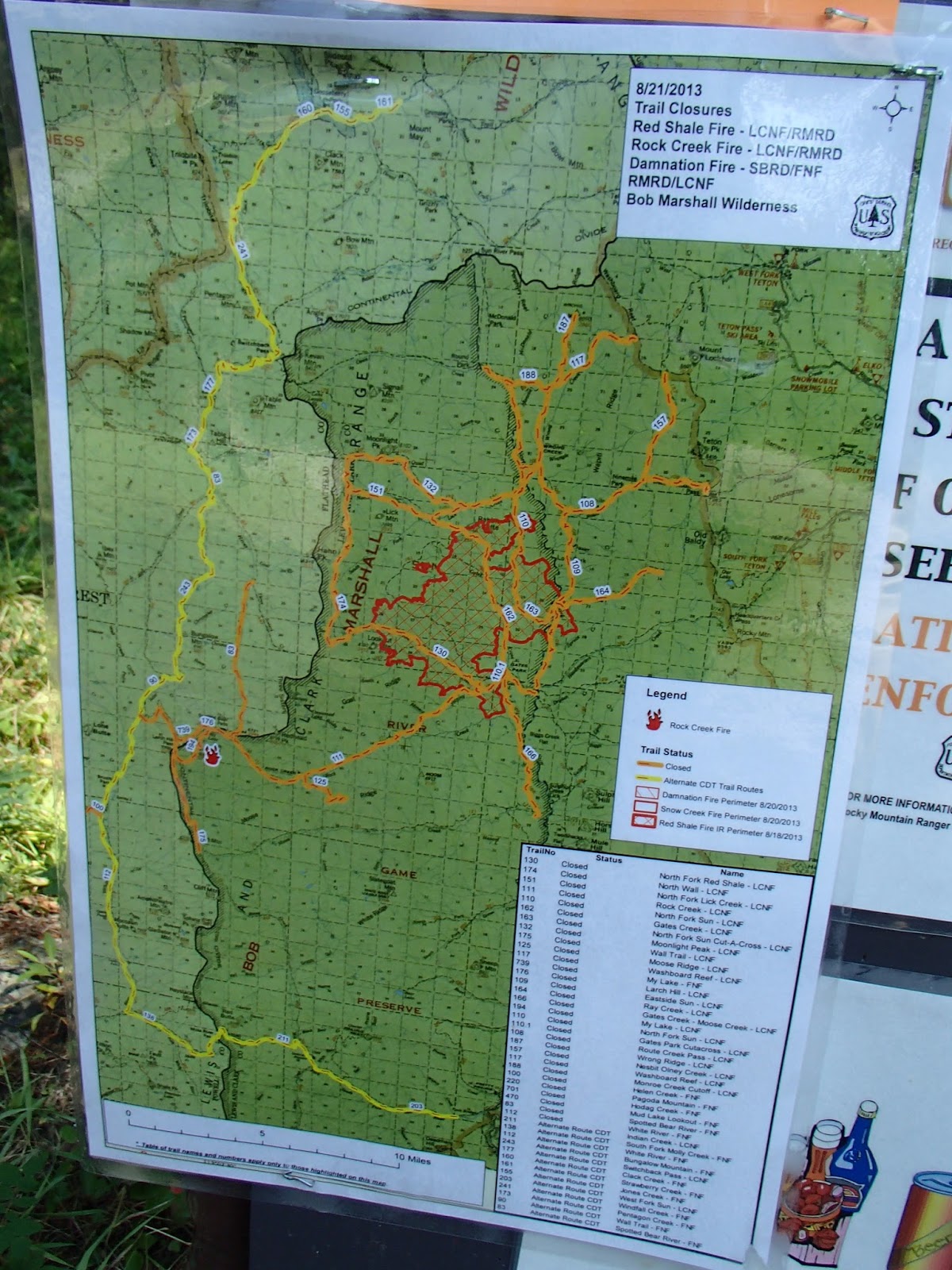
| The map of the fire closure: red=on fire, orange=closed trails, yellow=the alternate route the CDT goes thru |
 |
| In case you were confused by the map, there was a list of open and closed trails as well. |
 |
| Benchmark wilderness Ranch- horses in the yard |
 |
| Signage! |
 |
| Sunset from my camp, first night in "The Bob" |
 |
| That's smoke from the fires in the valley, not mist |
 |
| Lake |
 |
| Watching the storm roll over me from the front porch of a backcountry cabin |
 |
| Thimble berries! |
 |
| Ran into these guys in E. Glacier- hard to believe we started the CDT together almost 5 months ago! |
 |
| The view from Two Medicine Store |
 |
| Estero enjoying the view |
 |
| Malarky on the edge of the mountain |
 |
| Sycamore getting water before we got rained on. |
 |
| Real friends share the dry tent pad. |
 |
| The kitchen |
 |
| Hiking in the rain |
 |
| Looking toward Many Glacier CG |
 |
| I've officially walked in snow in all of the states on the CDT!(Minus Idaho) |
 |
| Estero walking into the mist along the Ahern Drift |
 |
| Grizzly prints on the last day |
 |
| Welcome! But not really... |
 |
| E, Neon, Estero, Malarky, and Sycamore are done! |